Sea level rise is a shared issue—floodwaters do not stop at jurisdictional boundaries. Given this, it’s important that local cities, towns, utility districts, and other entities cooperate as they plan to address sea level rise.
To ensure sea level rise adaptation planning coordination and consistency, County staff recommend local vulnerability assessments and adaptation plans use the same sea level rise scenarios used in the County’s BayWAVE Vulnerability Assessment process.
While many sea level rise modeling tools are publicly available, the BayWAVE process selected USGS’s Coastal Storm Modeling System (CoSMoS) to model sea level rise impacts countywide. This free tool can be accessed on the Our Coast, Our Future (OCOF) website .
The BayWAVE vulnerability assessment process selected six specific sea level rise scenarios, shown in the table below. These scenarios were selected using best available science and are consistent with current state guidance on sea level rise adaptation planning. They model near-, mid-, and long-term sea level rise, with and without the 100- year storm, and include the high tide and storm flooding we already experience in Marin.
| Sea Level Rise Scenarios |
| BayWAVE Scenarios |
Sea level rise |
+100-year storm |
| Near-term (approx. 2030): |
10 inches |
46 inches (3.8 feet) |
| Mid-term (approx. 2050): |
20 inches |
56 inches (4.7 feet) |
| Long-term (approx. 2100): |
60 inches |
96 inches (8 feet) |
To learn more about the range of available sea level rise models and the BayWAVE scenario selection process, please read this 2015 memo
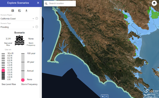
Image from the Our Coast Our Future (OCOF) web platform. Point Blue Conservation Science and U.S. Geological Survey. www.ourcoastourfuture.org (accessed June 2022)