San Rafael, CA – Marin County Parks has released its proposed 2018-19 Road and Trail Work Plan for its open space preserves and will present the draft plan to the Parks and Open Space Commission on March 15.
 There are nine projects on the proposed work plan for 2018-19 that are designed to meet goals of the Road and Trail Management Plan.
The plan, which directs use and management of roads and trails on the Open Space District’s 34 preserves, also will be discussed during a budget workshop on the afternoon of March 27. The Board of Supervisors will consider the plan in June as part of the County’s 2018-19 budget. All three meetings will take place in the Board chamber (Suite 330) of the Marin County Civic Center, 3501 Civic Center Drive, San Rafael.
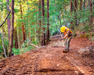
In its current draft, introduced online on March 5, the plan includes nine projects. The common thread these projects share is that they are designed to meet the three goals of the Road and Trail Management Plan: reduce environmental impacts, improve the visitor experience and safety, and maintain a sustainable trail system. The following roads and trails are targeted for various improvements in 2018-19:
- Eagle Rim Trail, Mount Burdell Preserve
- Middle Fire Road, Mount Burdell Preserve
- Old White Hill Grade, Loma Alta Preserve
- Alto Bowl Fire Road, Alto Bowl Preserve
- Bob Middagh Trail, Alto Bowl Preserve
- Conifer Fire Road, Gary Giacomini Preserve
- Blue Oak Trail, Rush Creek Preserve
- Toyon Fire Road, Cascade Canyon Preserve
- Ponti Project Planning, Pacheco Valle Preserve
“This year’s draft work plan encompasses a wide variety of road and trail improvements throughout Marin,” said Jon Campo, Senior Natural Resource Planner with Parks. “We worked with community members and staff to identify the projects, each important for resource enhancement and the visitor experience. As the projects move through the various phases of the planning process, we look forward to engaging the public through conversations and map review.”
This marks the third year implementing the Road and Trail Management Plan. Major accomplishments in 2017 included sustainability and emergency vehicle access improvements to the Irving Fire Road (Terra Linda/Sleepy Hollow Preserve), visitor safety enhancements to the Horse Hill Trail and adjacent grassland restoration (Alto Bowl Preserve), erosion control repairs and visitor use improvements to the Bob Middagh Trail (Alto Bowl Preserve), and adoption and sustainability improvements to the Hunt Camp Trail (Gary Giacomini Preserve).