 Explore the Marin Sea Level Rise Viewer
The new, interactive Marin Sea level Rise Viewer allows you to explore possible near term, mid-term, and long-term future sea level rise impacts anywhere in Marin County. Take a hyper local look at consistent, curated datasets in relation to the county’s sea level rise risk.
Want to learn more? Visit our viewer webpage for background and user tips!
 Submit your photos to the King Tides Project
The King Tides Project helps us visualize future sea levels by documenting today’s highest tides. Share your photos of Marin’s shoreline during King Tides or post them on social media (#kingtides) to help us create a record of how our shoreline is changing.
A big thank you to everyone who shared photos taken during our recent King Tides in December 2022 and January 2023! Check out the submitted photos gallery and remember to BE SAFE near high water.
**Curious where you can go to view King Tides? Explore a map of suggested locations in Marin.
 Visit the sea level rise station
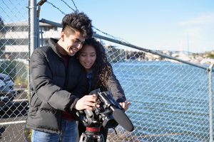
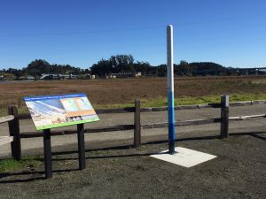
Visit the Richardson Bay Community Science Sea Level Rise Station along the Mill Valley-Sausalito Bike Path across from Tam High to learn more about how sea level rise will affect us in Marin County.
Use the onsite camera platform to capture images of the current shoreline and upload them with the hashtag #MarinSLR to help us document changing conditions in Richardson Bay.
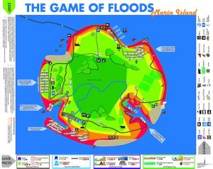
Play the Game of Floods
The Game of Floods puts you in charge of planning for sea level rise. Two versions are available:
- Download (requires printing and cutting)
- Available for purchase
Share a photo of your completed game board with #GameofFloods and show us how you adapted to sea level rise.
 Take action on climate change
The County's sustainability division has programs to help reduce carbon emissions and improve the sustainability of your home, business, and community.
Visit their website to access:
- Local resources
- Events
- Technical assistance programs