San Rafael, CA – Marin County’s first formal plan to manage roads and trails within its vast system of beautiful open space lands will be the subject of a community workshop October 3 in Lagunitas.
 Marin County Parks, which gradually has been acquiring lands for more than 40 years, is beginning to implement its Road and Trail Management Plan (RTMP), approved by the Marin County Open Space Board of Directors in December 2014. On Saturday, October 3, the public will have chance to hear how the plan affects Parks Region 2, which includes the Cascade Canyon, Gary Giacomini, Loma Alta, White Hill, French Ranch, Roys Redwoods and Maurice Thorner preserves. The meeting is to take place from 1-4 p.m. in the multipurpose room at Lagunitas School, 1 Lagunitas School Road.
The first regional rollout took place March 22, 2015, when parks officials discussed Blithedale Summit, King Mountain, Baltimore Canyon, Camino Alto, Horse Hill and Alto Bowl open space preserves. Three more community workshops for other regions are in the planning stages.
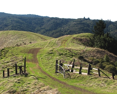
The RTMP was conceived to make roads and trails more safe, enjoyable, environmentally sustainable and financially manageable. The first step in RTMP implementation is the designation of a formal system of signed and maintained road and trail facilities.
Carl Somers, Marin County Parks’ Chief of Planning & Acquisition, said the network of roads and trails traditionally were inherited and added ad hoc as the lands were acquired. “This plan will help us establish and maintain clear internal priorities for maintenance and system improvements for the first time in 40 years,” he said. “By the time the plan is fully implemented, the open space preserves will be consistently signed and our roads and trails will be consistently maintained.”
Somers said system designation should lead to reduced conflicts among visitors and reduced impacts on the natural environment.
Once the formal system is established, work will begin to implement specific road and trail projects that would improve the designated network consistent with the RTMP’s multiple goals. Road and trail projects will encompass several types of activities, such as reroutes, reconstruction, new trail construction, active decommission, and road-to-trail conversions.
The October 3 workshop is an open invitation to neighbors of the preserves, environmentalists, cyclists, hikers, equestrians – anyone who enjoys open space preserves in the Upper Ross Valley and San Geronimo Valley areas managed by the County government. One major goal of the workshop is to seek reaction to maps depicting Marin County Parks’ proposed designations for the Region 2 preserves. Also, staff will review procedures developed since the RTMP’s adoption that will allow visitors to formulate and submit proposals for specific road and trail projects, consistent with policies, standards, and best management practices established in the RTMP.